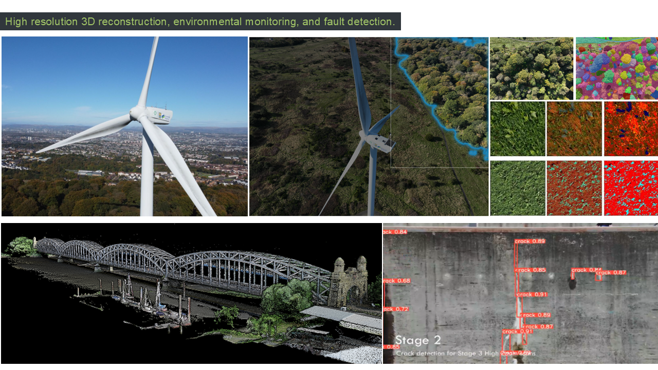
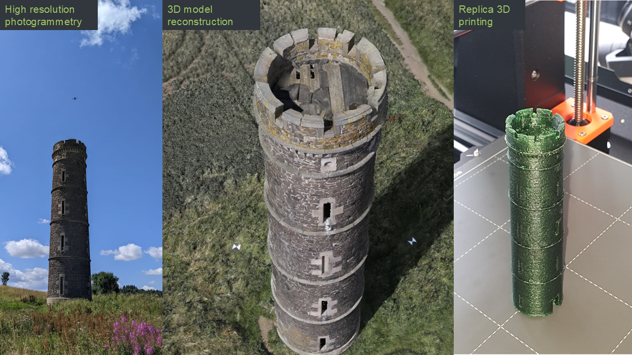
Our DJI M300 drones are equipped with survey grade LiDAR, HD, and hyperspectral cameras with RTK and PPK positioning and Starlink satellite broadband. Our team have completed mapping and inspection surveys across the UK and Europe using both drones and uncrewed surface vessels including motorway bridges, railways, wind farms, and heritage sites. Our research here focuses on digital twinning for structural health monitoring, fault detection, and environmental impact assessment.